


The BMW 7-Series to Feature HD Live Maps From HERE Technologies for Hands-Free Highway Driving in North America at Speeds up to 80 MPH
【Summary】BMW will soon launch its first vehicle in North America that supports SAE Level-2+ automated driving at speeds of up to 80mph /130 km/h. To support hands-free driving on highways in the U.S. and Canada, BMW’s flagship sedan will feature cloud-based, live HD maps from HERE Technologies.
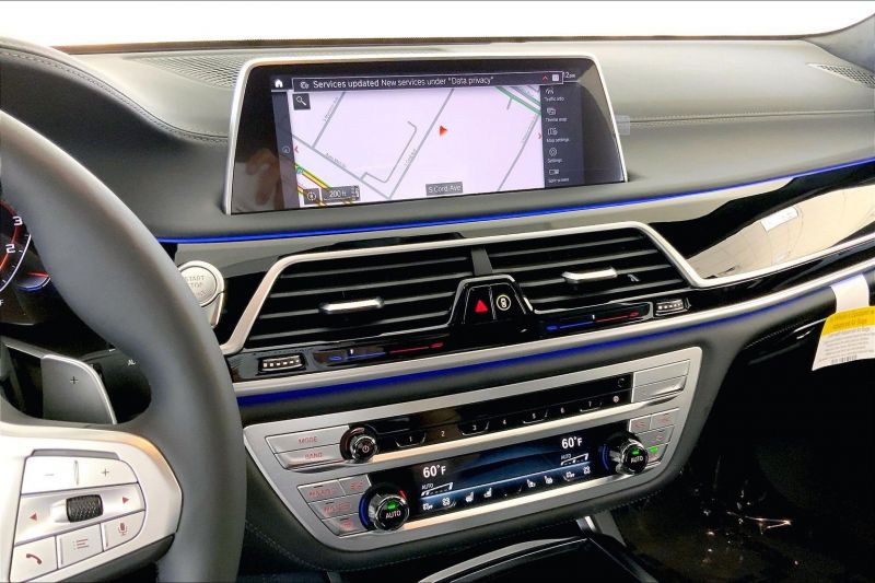
BMW will soon launch its first vehicle in North America that supports SAE Level-2+ automated driving at speeds of up to 80mph /130 km/h. To support hands-free driving on highways in the U.S. and Canada, BMW's flagship sedan will feature live HD maps from Netherlands-based HERE Technologies. These maps are highly accurate and provide centimeter level accuracy that is used to determine the exact position of the vehicle on the road.
The BMW 7 Series is the automaker's first series production model to use HERE HD Live Map for hands-free driving. In the future, HERE's HD Live Map will be integrated into additional BMW models as automated driving capabilities rollout to more roadways and regions as the coverage of HD maps expands globally.
It is important to note that the autonomous driving technology in the new BMW 7-Series is classified as SAE level-2 and requires that a driver remain focused on the road and be ready to take back control of the vehicle when prompted.
HERE Technologies is a leading location data and technology platform provider. The company is majority-owned by a consortium of German automakers, including BMW, Audi and Mercedes Benz.
HERE's HD Live Maps that support autonomous driving include semantic details not found on standard digital maps used by millions of drivers rely on for turn-by-turn driving directions. These maps include the exact position of lane markings, road signs, crosswalks, curbs and other infrastructure.
"A digital HD map is essential for highly automated driving," said Dr. Nicolai Martin, Senior Vice President Development Automated Driving at BMW Group. "HERE HD Live Map is rich and reliable: it provides road geometry, route profile and traffic signs – all on a global scale."
HERE's HD Live Map is also cloud-based and can be updated in near-real time with sensor data from other connected vehicles. The maps enable a self-driving vehicle to "see" beyond the limits of sensor visibility, apply contextual awareness of the upcoming road environment to make better driving decisions.
The HD maps consists of highly accurate data to determine not only a vehicle's precise position on the road, but what it will encounter ahead. This lane-level map data serves as a redundant source of information to the vehicle's on-board sensors, providing an additional layer of safety for the system.
All of HERE's location-based data is anonymized to protect privacy.
"We're delighted to see our HERE HD Live Map enable automated driving at Level 2+ for BMW series production vehicles," said Fred Hessabi, Executive Vice President and Chief Customer Officer at HERE Technologies. "This collaboration demonstrates the value
of maps for highly automated driving. We look forward to supporting the expansion of Level 2+ to all types of roads, everywhere in the world."

BMW's ongoing collaboration with HERE technologies also includes integration with the automaker's latest vehicle operating system (OS) with a new feature called "Learning Navigation", which was announced in June. BMW was the world's first automaker to deploy HERE's predictive routing technology in its vehicles.
BMW Group's Research and Technology arm began working on predictive routing technology back in 2009, as part of BMW's "EfficientDynamics" strategy to reduce fuel consumption. The multi-year agreement to power BMW's Connected Navigation Services (CNS) is available across vehicle models in 70 countries.
HERE's Predictive Routing feature actively monitors real-time traffic conditions along regularly traveled routes. The company aggregates and analyzes billions of data points from a mix of sources, including vehicle sensor data.
In the future, more BMW vehicles will utilize HERE's Real-Time Traffic to provide drivers with up-to-the-minute information on road conditions and incidents. The service assists drivers by providing detailed information on traffic congestion with lane-level precision and provides warnings of potential road hazards ahead. HERE's Real Time Traffic also provides information on lane closures and traffic flow for specific lanes, including high occupancy vehicle (HOV) lanes.
Using HERE's Real-Time Traffic platform, the vehicle's navigation system will automatically offer alternative routes or departure times to a driver before heading out based on the current road conditions and traffic environment. Drivers can also receive a predictive traffic forecast to help them plan trips on the "My BMW" app before entering the vehicle.
"We have been working with HERE for many years to bring highly automated driving to market, and we are now thrilled to see the result of our collaboration finally come to life. Together, we are going one step further in delivering on our promise to provide a superior driving experience," said Dr Martin.
In 2021, HERE Technologies announced that it created highly detailed 3D models of 80 major cities around the world to help urban delivery drivers find their way around. The models are called "HERE Premier 3D Cities" and are used to visualize cities in 3D.
In the future, these 3D city models will be accessible via a vehicle's navigation system, giving drivers a real world view of their surroundings while traveling in dense urban areas.
HERE's Premiere 3D Cities data can be used by third-party software developers to build accurate 3D representations of 75 major cities worldwide. Developers can also add advanced rendering techniques, such as CGI applications.
The 3D city models include fully indexed and addressable buildings and structures to indicate points of interest. HERE said it will continue to add new cities to the list in the future.
-

Ford is Testing a New Robotic Charging Station to Assist Drivers of EVs With Disabilities
-
Ford Raises the Prices of the F-150 Lightning Electric Pickup Due to Rising Raw Material Costs
-

AutoX to Use the 'Eyeonic Vision Sensor' from California-based SiLC Technologies for its Robotaxi Fleet in China
-

LG Develops ‘Invisible’ Speaker Sound Technology That Could Revolutionize In-Vehicle Audio
-
Researchers at South Korea’s Chung-Ang University Develop a ‘Meta-Reinforcement’ Machine Learning Algorithm for Traffic Lights to Improve Vehicle Throughput
-
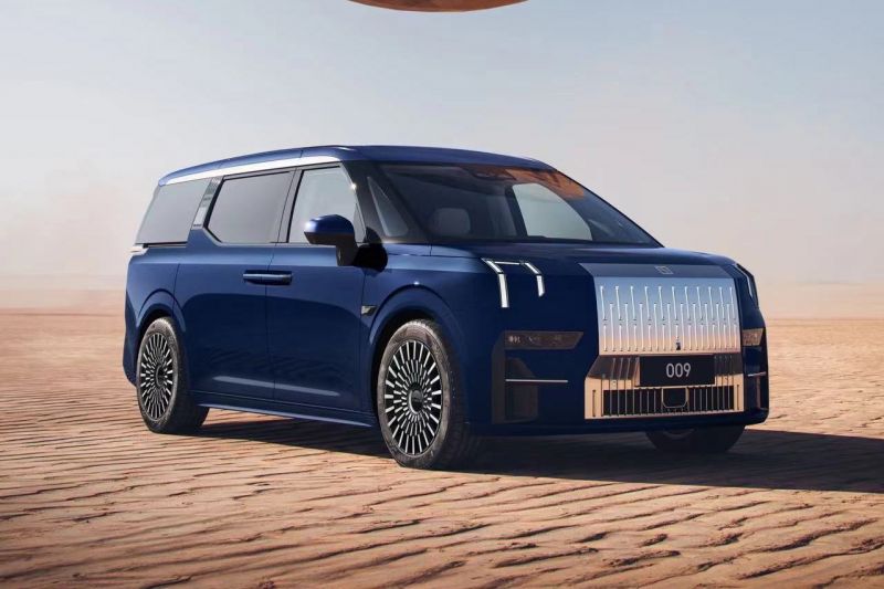
Zeekr’s New 009 Electric Passenger Van is the World’s First EV to Feature CATL’s Advanced ‘Qilin’ Battery With a Range of 510 Miles
-
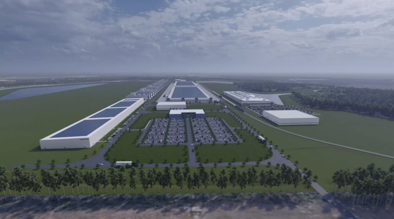
Redwood Materials is Building an Electric Vehicle Battery Recycling Facility in South Carolina
-
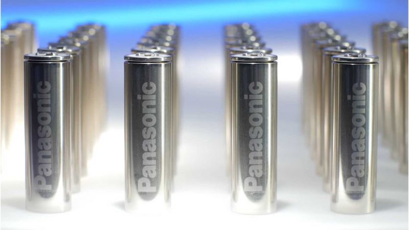
Panasonic Announces Multi-Year Agreement to Supply Electric Vehicle Batteries to Lucid Group


- BMW to Test a New Battery in the iX Electric SUV Developed By Michigan Startup Our Next Energy Inc. That Can Deliver 600 Miles of Range
- Volkswagen CEO Believes It Will Overtake Tesla in EV Sales by 2025
- Nexar Releases its ‘Driver Behavioral Map Data’ That Can Help Autonomous Vehicles Operate More Like Human Drivers
- China’s Baidu Reveals the Apollo RT6, a Fully Autonomous, Production Ready Level-4 Robotaxi with Removable Steering Wheel
- GM Expanding First Responder Training Program for EV Crashes
- Redwood Materials is Building an Electric Vehicle Battery Recycling Facility in South Carolina
- Sony, Honda Sign Agreement for Joint EV Brand
- Waymo Reveals its New Robotaxi Built by New Premium Electric Vehicle Brand Zeekr
- BMW i Ventures Invests in Vendia, a Next-Gen Blockchain Company Helping Businesses to Securely Share Data With Third Parties
- Mercedes-Benz is Offering a Performance Upgrade as a Yearly Subscription on its EQ Electric Vehicles
 About Us
 Contact Us
 Careers